LakeSPI (Lake Submerged Plant Indicators) is a lake information and management tool used to assess and report on the ecological condition of New Zealand Lakes. This page should help you use the LakeSPI web reporting portal to find and view all available LakeSPI results
For information on how to use these results for regional and national reporting, see reports.
On the Home page you will see a side search bar and a main workspace divided into tabs for the different summary views of the LakeSPI results: Map, Table, Chart and National Status.
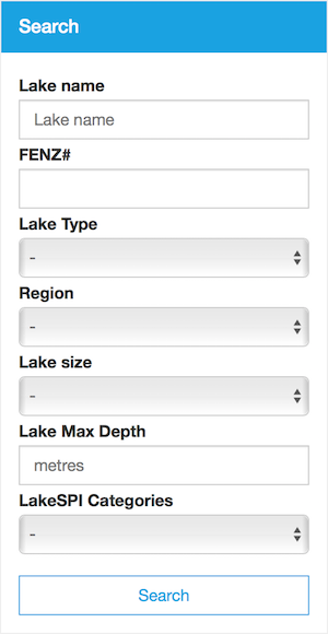
LakeSPI Search Panel
The search panel allows you to select which lakes you want shown in the summary views. Only lakes where LakeSPI information is available will be shown in the search results. Hint: If you want to see all lakes with LakeSPI information available, search leaving all search options blank.
|
 |
LakeSPI Summary Views
Map |
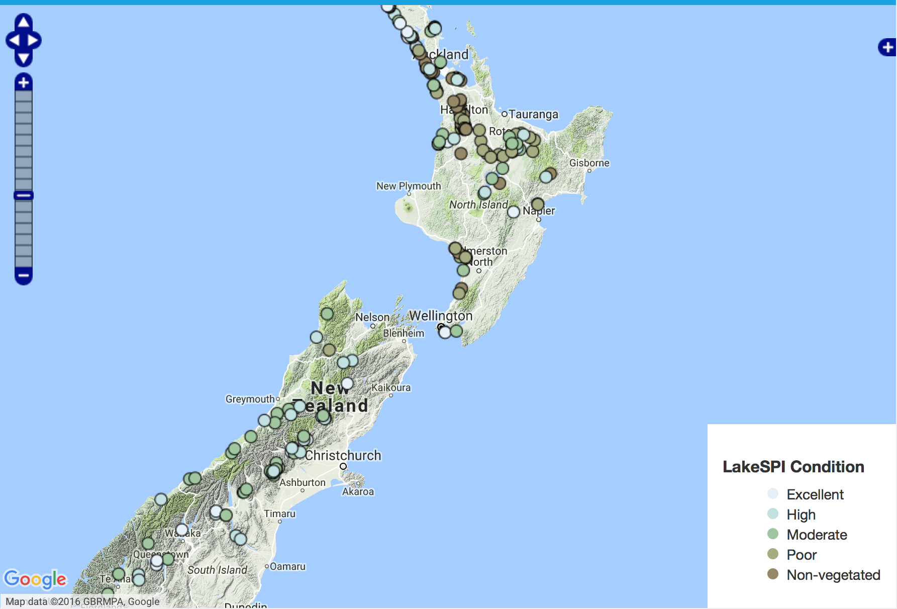
The Map view shows all of the surveyed lakes matching the search filter on a map of New Zealand. Each lake is colour coded according to the LakeSPI Condition. You can pan and zoom into the map, click on lake markers to find out more about each lake, and link through to the full lake report. |
 |
|---|---|---|
Table | The Table view shows the selected lakes along with details of the Lake Status, Date of last survey, and small bar charts for the LakeSPI Indices. You can sort the table by clicking on any of the column headings, so for example you can list the lakes by date of last survey, or by invasive species index. The default sort order is by descending LakeSPI Index. Click on the lake name to see the full report for that lake. |
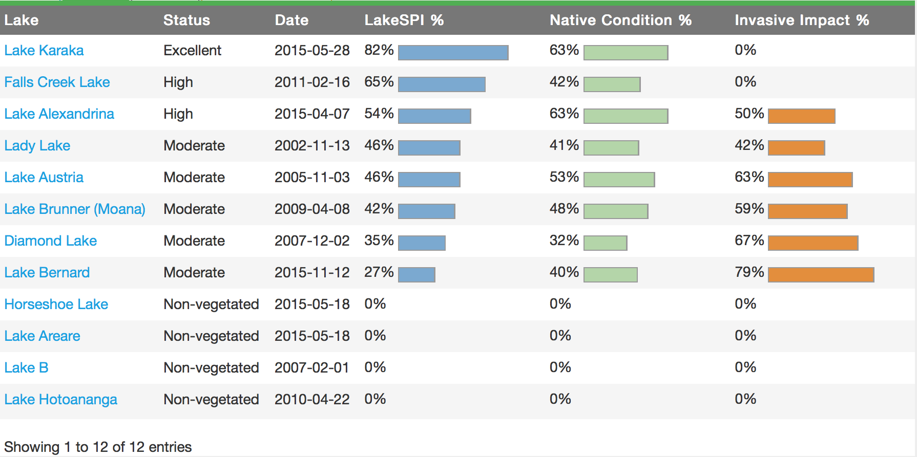 |
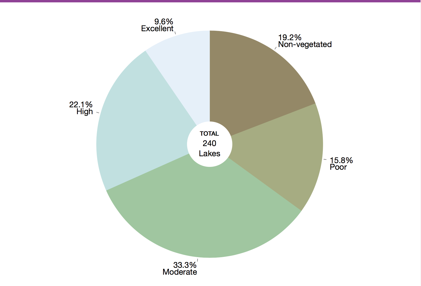
Chart | The Chart view contains a pie chart showing the relative proportion of each LakeSPI condition type: non-vegetated, poor, moderate, high and excellent Try selecting different lake origins such as Glacial or Volcanic, or different regions such as Northland or Southland to get an idea of the overall quality of the lakes. |
 |
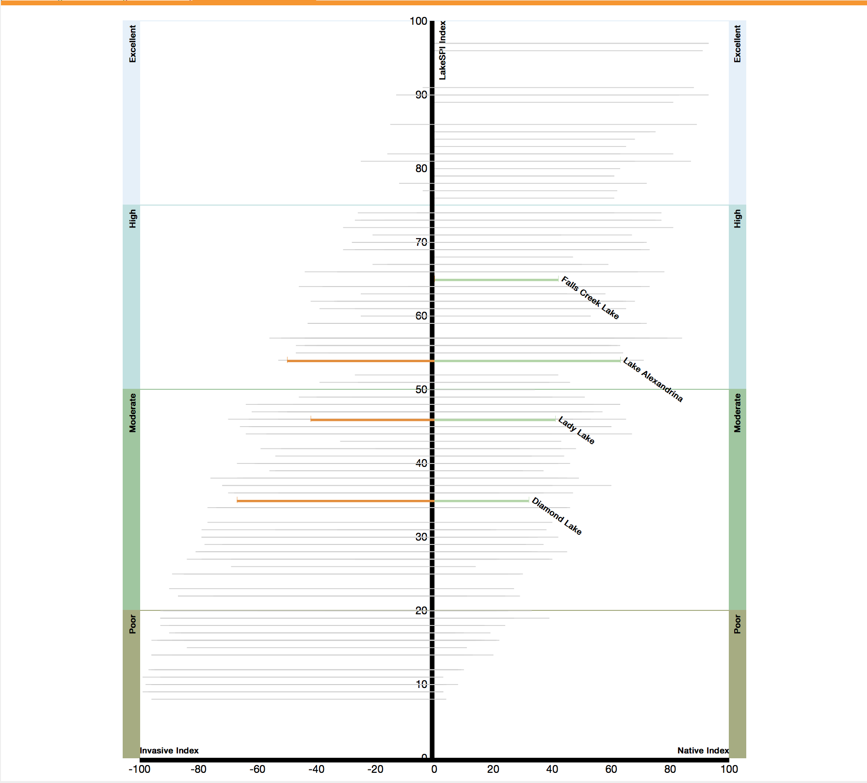
National Status | The National Status view shows where each selected lake sits in comparison to all other New Zealand lakes, where LakeSPI results are available. It graphs only the most recent LakeSPI results for a lake and plots the Native Condition and Invasive Impact indices next to the overall LakeSPI Index. This National Status report is not interactive, but will update as you change the search filter. |
 |
More information can be found on the main NIWA website: http://www.niwa.co.nz/our-science/freshwater/tools/lakespi